RACELOGIC Support Centre

SatGen 4 Software

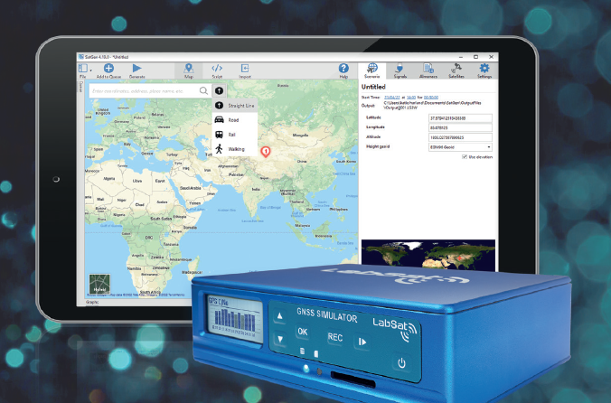
The SatGen 4 software allows you to create a GNSS RF I&Q or IF data file based on a user-generated trajectory file that you can replay on a LabSat GNSS Simulator.

SatGen 4 is a great tool to use when you wish to test your device in locations that you’re unable to visit, including hostile environments and areas with strict travel restrictions. It also eliminates the cost and inefficiency of performing multiple field tests and it allows you to test at any point in time, past or future. You can create scenarios to test specific product attributes, such as geofencing, and you can add timed stops to simulate multi-stop routes.

SatGen 4 compliments the LabSat range of GNSS simulators and is available in single, dual, triple, multi-frequency/multi-constellation and Real Time versions

SatGen4_splash.png
LabSat product with SatGen on tablet.png
  • Improved route drawing with road, pedestrian, rail and straight-line routing (depending on the map provider).
  • New map control with multiple map providers, such as Google Maps, Bing Maps, OpenStreet and AMap.
  • Location search by name or address for quick navigation.
  • New User-Interface with intuitive navigation and controls.
  • No distance limits for the routes drawn on the map. 
  • New script editor with interactive code completion and error highlighting.
  • Select individual satellites to simulate.
  • Queue and automatically run consecutive scenarios.
  • View almanac contents.
  • Most popular formats can now be used for entering coordinates.
  • Track the current position on a map during real-time simulations.
  • Satellite visibility for the start location and time.
  • Edit custom leap seconds and ionospheric model parameters.
  • Was this article helpful?